A Border Is Not Always a Wall
Understand what border news means by separating jurisdiction, terrain, movement, and official rules, so you can read claims about crossings more precisely.
What does it mean when a news story says a border is open, closed, or crossed? A border is a boundary between jurisdictions, not necessarily a wall or a single checkpoint. To read the claim accurately, distinguish the legal line from the routes, facilities, and rules that govern movement nearby.
A report about a closed road crossing can coexist with one about people moving across an unmarked stretch of terrain. Those claims refer to different routes and possibly different rules. The useful question is not simply whether “the border” is open, but what movement is affected and where.
A border describes jurisdiction, not a structure
A boundary is a defined line separating areas under different political authority. A wall, fence, gate, or checkpoint is a physical feature or facility that may be placed on or near that line. The two can coincide, but they are not interchangeable.
Maps draw boundaries as thin strokes so they remain legible. On the ground, the line may cross farmland without a visible marker, follow a river, or pass through a city. Its jurisdictional meaning does not depend on a wall being present.
News wording can blur the distinction. “The border was sealed” might describe a government decision affecting official crossings; it does not, by itself, establish that a barrier spans the entire boundary. A report about a new fence describes a structure, but its location and extent still need to be specified.
When you see “at the border,” separate the boundary from any facility or barrier the report actually names.
Terrain shapes the relationship between map and ground
A boundary may cross mountains, farmland, rivers, or built-up areas, and each setting can make it appear different. In steep terrain, a line may cross a ridge or slope. In an urban area, a jurisdictional boundary may pass between neighborhoods without a conspicuous change in the streetscape.
Rivers can be boundaries, but a map’s depiction of a watercourse may not settle the precise legal line. Channels can branch or shift, and the applicable boundary description may require more care than pointing to the nearest bank.
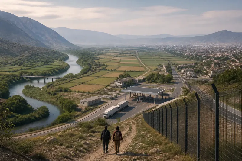
Photographs also have limits. A picture of a fence shows a structure at the pictured place; it cannot establish that the same structure continues along the whole boundary. An image of open ground cannot establish that movement there is permitted.
Read a map or photograph for what it depicts, not for rules or coverage it cannot show.
Crossings and checkpoints refer to particular facilities
A border crossing is a designated place or route where authorities manage passage. It might include road lanes, inspection booths, rail facilities, or a port. Its operating status concerns the facility and the types of movement described, not automatically every part of the boundary.
A checkpoint may be some distance from the mapped line, controlling a road within a border region. It is not necessarily the international crossing itself. Similarly, immigration desks at an airport manage entry through that airport; they do not show whether a nearby land boundary has a barrier.
Say a report states that an official road crossing between two countries has stopped vehicle traffic. The claim concerns that route and that category of movement. If another report mentions a footpath used elsewhere, the accounts may describe different places and conditions rather than contradict one another. Track the route, travelers, and type of movement in each claim.
Movement and permission are different questions
“Crossing the border” can refer to travel through an official facility, movement across an unmarked stretch, or a change in political control. A person may travel by road, rail, boat, or on foot; freight may pass through a port or land facility. Headlines sometimes leave the route unstated, so read the body for the missing detail.
Separate physical access from legal permission. A path may be physically passable while rules restrict who may use it or what may be carried. An official crossing may be operating while some travelers or shipments remain ineligible. Geography answers whether a route connects two places; rules address who may use it and under what conditions.
“Open” may mean a crossing is operating or that a particular kind of traffic is allowed. “Closed” may refer to a temporary suspension at one facility. Neither word alone tells you whether all movement across the boundary has stopped or resumed.
Use a border reading checklist to test the claim
For each item, note the observation in the report and follow the corresponding decision. If the report omits a detail, keep the claim narrow instead of supplying an assumption.
- Jurisdictions: Check whether the report names the countries or authorities on either side. If it does, use those names to identify the boundary; if it does not, treat the political setting as unresolved.
- Location: Check for a named town, road, pass, river, port, or facility. If one appears, tie the event to that place; if none appears, do not assume it concerns a particular crossing or the whole boundary.
- Feature: Check whether the story describes a mapped line, fence, gate, checkpoint, or road. If it names a physical feature, distinguish that feature from the boundary; if it does not, avoid inferring that a structure exists.
- Movement: Check whether the claim concerns pedestrians, vehicles, rail traffic, or freight. If the type is specified, limit the claim to that movement; if it is not, leave the scope open rather than treating every kind of travel alike.
- Operating status: Check whether “open” or “closed” applies to a named facility and time. If both are given, describe that facility’s status; if either is missing, do not turn the wording into a claim about all border movement.
- Visual evidence: Check whether a photograph or map shows a labeled place and what feature is visible. If it does, use it to locate that feature; if it does not, rely on the image only for its visible terrain, not the boundary’s full extent or legal rules.
Imagine a fictional report says the “East Vale crossing” has closed to freight, while a separate caption shows a fence beside a road nearby. First, note that the report names one crossing and a freight restriction. Next, record that the caption shows a fence near a road, without establishing that the road is the crossing or that the fence continues elsewhere. The sound reading is that freight passage at the named facility has been reported as closed; the available wording does not establish a closure for pedestrians, other routes, or the entire boundary.
What do readers ask about borders?
Does every international border have a wall?
No. A border is a jurisdictional boundary, and some sections may have no built barrier. Terrain, settlement, and government policy can differ along the same boundary.
Does a closed crossing mean the whole border is closed?
Not necessarily. The report may concern one named facility or route, and it may apply only to particular travelers or traffic. Check the location and scope before extending the claim.
Can a river form an international boundary?
Yes, a boundary may follow a river or be defined in relation to one. The exact line can depend on the relevant legal description, so a map’s watercourse may not answer every detailed boundary question.
Can a photograph show that a fence covers the whole border?
A photograph can show a fence at the pictured location, but it cannot establish how far the structure extends beyond the frame. Look for a description of its location and extent rather than inferring coverage from the image.
Keep claims about borders within their stated scope
When reading international border news, distinguish the jurisdictional line from the terrain, facilities, and barriers around it. Then connect any reported closure or opening to the place and type of movement the story actually identifies.
If a report leaves those details unclear, preserve that uncertainty. The most useful next detail to look for is the named route or facility and the specific movement affected; those particulars let you interpret the claim without turning a local event into a statement about an entire boundary.